28 May – Fairbanks to the Canadian border.

When we woke up, there was another ToyHouse parked beside us.  This looked to be about an 89 – 90 Seabreeze. It had Alaska tags and the owners slept in, I was going to leave a not on their window but didn’t think about it until after we had left the lot.


(NOTE – We seen another ToyHouse heading north about noon, about 50 miles south of Fairbanks)

Jodie wanted to return to her favorite breakfasts place, “Sourdough Cafe”, so we stopped in there before heading out of Fairbanks.

We jumped on the Richardson (AK-2) and started south. We passed through the town of “North Pole”. Obviously this isn’t “the North Pole” but this town is famous every year for being able to deliver Santa and all his toys from the North Pole.  We didn’t think of it at the time, but this would have been a good opportunity to mail some post cards to get that infamous “North Pole” mail cancellation on them :-).  Put that on the list for next time.

Farther down the road at Delta Junction, we filled up the tank. They were having their Memorial Day celebration and we caught the horse drawn wagon as it passed the gas station.

Delta Junction is the official end (or beginning of your heading south) of the Alaska Highway, So this is where we officially start on the Alcan.

We hadn’t seen this section of the Alcan yet as we took a different rout when we were traveling north.

Traveling south of Delta Junction, we passed over the Richardson River. It still had ice 10 ft thick and as blue as could be.  Farther down the road we stopped for a Moose who was eating beside the road.  This one wasn’t spooked and stayed right there, less that 15 ft from the Toyhouse as we were able to snap a couple photos.

We stopped for the night at an RV Camp “Border City Lodge”. We’ll top of the fuel tanks in the morning before proceeding into Canada.

Hopefully, we’ll see a little “Dark” tonight.

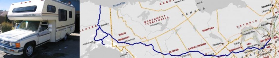
Trip Odometer 6,285 miles

John & Jodie

Posted in On the Road | 2 Comments

27 May – Coldfoot to Fairbanks

The sun never set last night.  Our camp site is surrounded by mountains and I could see the sun hitting the peaks of the mountains.

The one thing we didn’t see last night was bears.  As I said yesterday, this camp site is regularly visited by bears as evidenced by paw prints, etc.

We had a nice hot cup of coffee and decided to break camp and eat breakfast in Coldfoot.

The Coldfoot stop is just about 1/2 way between Fairbanks and Deadhorse, and its the only stop, so guess what, Coldfoot is a nightly hive of activity as truckers stop in for the night.  The breakfast can be bought off the menu of they have a modest buffet.

After filling up the tank ($5.89 / gallon) we opted for the buffet, it was a sunshine warm morning so we sat out side on their patio and ate our breakfast.

We hit the road again and time went fast. The only activity on the roadside this morning was a fast moving Moose wanted to play chicken with me.  He was walking along side the road and when he heard us coming he turned, looked, and then wondered up into the bush.
Farther south, the Dalton passes over the Yukon River.  They sometimes use barges to float equipment up and down the Yukon during the thaw.


We got into Fairbanks about 3pm.  The first order of business was to find a car wash.  The Toyhouse was covered in mud, so it took a couple passes with the pressure washer to get most of it off. It probably weighs about 500 lbs less also.

We drove around Fairbanks looking for the Walmart that we had visited on the way up.  We needed to resupply a couple things and decided just to spent the night in the Walmart lot (At most of their stores they allow RVs to spend the night in their lot)

Although the sun does set in Fairbanks, it doesn’t get dark, so, basically, we haven’t seen a dark night in almost a week 🙁

Tomorrow we’ll start heading south  on the Alaska Highway.

Posted in On the Road | Leave a comment

26 May – Arctic Ocean

Midnight Sun – I’m here to tell you, all that stuff about the sun setting in the west and rising in the east doesn’t work here. At 1:30am I went outside and looked due north, I saw the sun sitting low on the horizon, and it was moving toward the east.  Our Toyhouse is parked in the parking lot of the Arctic Caribou Inn, and this is what it looks like a 1:30 am.

By the way, it was about 30 Degrees outside.

We had our blackout screens on the roof vents and the main door, we also put some towels over the windows just to darken it some more in the ToyHouse.

Awake again at 6:30, uploaded to the web site before the speed crashed and got time outs.

The tour started with a nice intro from our guide.  The guide showed us a 10 minute video that describes the operations at Prudhoe Bay, then everyone on the bus for a two hour tour of the oil fields and a trip 12 miles north to the Arctic Ocean..

First stop was the “Prudhoe Bay National Forest”. Then around to some of the crew “Camps”.  They look kind of like 50 of those FEMA trailers bolted together, Each company has their own facilities (Camp)where they house feed, sleep, for the crews. Basically, there are no permanent residents here, everyone is temporary – 2 to 3 weeks at a time, and there are just shy of 10,000 people here at any time.

They don’t drill or explore in the summer, only the winter. Summer is for maintenance and getting ready for the next season

ARCTIC OCEAN  🙂

One of the main goals was to swim (wade) in the Arctic ocean, Well, that wasn’t going to happen because its still frozen over, but we did get to “Walk” on the arctic ocean.

After the tour, we ate lunch in the Toyota Diner.  Jodie needed to pick up a couple items from the store and I needed to fill the fuel tanks before heading south.


HEADING BACK SOUTH

We left Deadhorse about 1pm, and planned to stop around Coldfoot. On the way up we scouted several good candidates to spend the night.

We did see a see a herd of about 20 Musk Oxen along with three calves grazing beside the road.


We stopped about 40 miles north of Coldfoot, on the Dietrich River.  This was about 500 ft off the road so we didn’t get a lot of road noise.  The place we set up camp had signs of a Bear, there were bear prints in the shore line and and do-do around the site.

Fortunately, we didn’t see any bears that night.

Again, it was the same deal with the sun set,  There was none,  It was light and the sun was up all night.

Sleep tight, I’ll post more when we get a WiFi connection.

(Posted from Walmart Parking lot, Fairbanks Alaska)

John and Jodie

Posted in On the Road | 1 Comment

25 May – Deadhorse – We made it!!!

Toledo, Ohio to Deadhorse, Alaska in 12 days (we made a few side trips) and 5200 miles.

We seen our first Polar Bear.  He was beside the road in front of us, as we got closer (200 ft) he started walking up toward the mountains.  We stopped and watched him for about 15 minutes before continuing down the road.

The toughest climb was up Atigun pass, 600 ft to 4600 ft in about 5 miles.  We made the climb up in 1st gear doing about 25 – 30 mph.


The Dalton Highway is various conditions of roughness. There are a couple points were we were cruising along at 10 mph because the road was so bad, then at times we could cruise at 50.

I think the best is the packed gravel, there are few surprises, you know it sucks.

We arrived in Deadhorse about 2pm.  We stopped at the Deadhorse Information Center (a sign with a “Free Map” box).

We checked in at the Arctic Caribou Inn. They do the Arctic Ocean/Drilling rig tours. The only way to get access to the Ocean is via one of the tours. No private vehicles north of town and to the oil drilling rigs.

We needed a couple things from the store, so a swing by the Prudhoe Bay General Store.  This store is the ONLY place to show, kind of like the “Walmart” of Deadhorse.  The building is also the Post Office, the Auto Parts store of Deadhorse, The “in” place to shop.  (the only place to shop)

Just found another fact about living here in Deadhorse, internet connectivity can rival the haul road.  I’ve tried several times to connect and update the blog, but its been very, very, slow, and I would get timed out when trying to upload some of the photos.

We scheduled our tour for tomorrow (they need 24 hour notice), so back to the ToyHouse Hilton for the night.

Deadhorse Sunrise/Sunset  >  It Doesn’t – The sun stays up 24 hous a day.

Koyukuk River to Deadhorse > 223 miles  > 14.1 mpg

Posted in On the Road | Leave a comment

24 May – Heading up the Haul Road (Dalton Highway)

24 May – Heading up the Haul Road (Dalton Highway)

We packed up camp and departed Fairbanks this morning. We both had a good nights rest, in spite of it not getting dark. We’re far enough north even though the sun sets, it doesn’t get dark.

As we were heading out of Fairbanks, we stopped by a nice little place for breakfast, Sourdough Cafe, LOT OF FOOD. We got a to-go box, so we’ll be eating Sourdough Cafe breakfast for a day or two.  🙂

The route north first starts on Steese highway (AK-6) to the town of Fox, then the Elliot Highway (AK-2) just past Livengood Then its the Dalton Highway (AK-11) north.

The Dalton is mainly dirt/gravel. there are some places where its paved, but either paved, or gravel, they both have their downfalls, seriously, I think I like the gravel better.  The paved tricks you into a sense of false security, you’ll be cruising along and all the sudden, you run into the wavies (mini hills that after abut three in a row, the truck starts bottoming out.  Also the Frost hievs, All the sudden the paved road has a 6 inch hole in it where the frost has destroyed the pavement.

Anyway, the first 20 miles of the Dalton are the worst I’ve seen yet,  (I wonder if this is intentional to discourage the average tourist??)

The road does improve and on some occasions, I was able to do the posted speed limit of 50mph.

The Dalton runs parallel to the Alaska Pipeline, so for most of the drive, the pipeline is usually in site  near the road.

We stopped at a Pipeline very informative display, and you can walk right up and touch the pipeline.

We made a fuel stop at Yukon River crossing. Seems we’ve crossed this river before. 🙂

Jodie made the observation that all those nice pretty photos you see of these places in the magazines do NOT match the real life image. Generally, your a little (lot) let down when you see the place in person as opposed to what they look like in the magazine.

The next stop was at the “Arctic Circle”  This is a line at 66′ 33″ north, that marks the line that on Summer Solstice (June21) the sun will not set for at least that one day.  Anything south of this line and the sun sets everyday. Anything north, and you can expect at least 1 24 hour day.ther north, the more days of 24 hour sun)

SEE Sunrise/Sunset web site.

On the road again and the next stop was at Coldfoot.

Remember my remarks about the magazine photo’s  BIG TIME HERE. Anyway, we fuel up and headed north to find a place to stop for the night.


We checked a couple potential places, but Jodie found one that was almost perfect.

Its about 100 ft off the road and right beside a small river (Koyukuk River middle fork 3) overlooking one of the largest granite mountains we’ve seen in the area.  Most of the small mountains have vegetation, trees, etc, but this one has nothing, stands out by itself.

We’ll see about truck noise, We’ve been here for a few hours and I bet I’ve seen one truck about every 1/2 hour.

Anyway, we’re settling in for the night here.  We’ll post this next time we have internet access.

Coldfoot   Sunrise >  3:09am    Sunset > 12:15am

Mileage Fairbanks to Koyukuk River > 308      13.8 mpg

John & Jodie

Posted in On the Road | Leave a comment

23 May – North to Denali

Departed Anchorage after a couple stops to resupply, empty the waste tanks and refill the fresh tank.

Anchorage is surrounded by mountains, Today, it was warm, dry, and dusty.  If I had just woke up and didn’t know where I was, I would swear I was in Southern Calif, say around Burbank.  Same kind of people atmosphere.

Anyway, we’re driving north on AK-1 toward Palmer, Jodie needed to stop at the Post office for stamps and mail cards. Right across the street from the post office was the “King of Donuts”. Well, we’ll need to check out this claim!!. Sure enough, we walked out of there with 1/2 dozen, and an espresso for Jodie and a carton of milk for me. Yup, these were good donuts 🙂

I’ve been told by many that its rare to see Denali on a clear cloudless sky, so I guess we are very fortunate.  Look at the picture on the right.  This cloud is actually east of Denali and you could see snow coming out of it.  This cloud is caused by Denali.

We headed north toward Fairbanks,  with a few stops at /view Denali (Mt McKinley)  Fortunately, the weather was absolutely beautiful, and just a few clouds in the sky.

Farther north near Fairbanks, Jodie and I switched driving.  30 minutes after she took the wheel, she had to do a panic stop when a huge moose came strolling out of the woods and started walking down the road about 50 ft in front of us.  He turned and gave Jodie a dirty look and slowly wondered in front of us and down into the woods on the other side of the road. I could hear him mumbling under moose breath; “Damn Tourist”

When we got into Fairbanks, we decided to stop and eat before settling down. A place called Airport Way Restaurant on Airport Way, good prime rib and good halibut. (Expensive – but everything is expensive here!!)

Oh yah, Gas was $4.19 in Anchorage and Fairbanks.

We pulled into a nice Campground for the night – Tanana Valley Campground and RV Park.  $26 for the night with electric, showers, etc.  They also run several tours. Check them out at:

http://fairbankscampgroundandrvpark.com/

I think we’re far enough north again that it won’t get dark after the sun sets. I’ll let you know tomorrow.

Fairbanks Sunrise > 4:02am   Sunset > 11:32pm

Mileage > 416    15.1 mpg

JOhn & Jodie

Posted in On the Road | Leave a comment

22 May – Off to Anchorage

We departed Valdez after coffee and breakfast in the Toyhouse.

We drove around to the other side of the Valdez inlet, to where the Alaska Pipeline terminal is.   Hopefully, we’ll be seeing the other end of the pipeline (Prudhoe bay) by the end of the week.

Our route today took us backtracking from Valdez, back to Glennallen, then a west turn toward Anchorage.  The drive was along a mountain chain that produces several Glaciers that flow inland, we stopped a couple of times and hopefully got some good photos.

This was one of the objectives of the trip, to see glaciers, well today, we weren’t disappointed.

We’ll spend the night on the shore of the Knik River, It seems to be a popular place for the dune buggy guys, Hopefully they won’t be spending the night too.  🙂

Anchorage Sunset > 10:56 pm,  Sunrise > 4:57 am

Mileage >> 294  –  15.1 mpg

John & Jodie

Posted in On the Road | Leave a comment

21 May – Heading to the Oil Country

Today we’ll head west toward Valdez, and the southern most point of the Alaska Pipeline.

The providential camp (Klondike River) was nice and quite.  I think there were only three of us in there out of maybe 40 spots.  I checked with the ranger about any bear sightings, he said none so far this year, but always take precautions.
Breakfast and coffee in the Toyhouse, broke down camp and hit the road.  The providential campgrounds are very nice, and at $12 a night, can’t beat the price.

There  is no bridge that crosses the Klondike river. The state runs a free ferry back and forth between the north and south shores.  The river is full and moving fast and erodes the shorelines, so they have a full time operator just keeping the river embankments fixed so vehicles can load onto the ferry.

On the other side of the Klondike river, its uphill to the Top of the World Highway.  The name “”Top of the World” is named as the road runs along the top ridge of a long mountain chain. In many locations along the road you have an unobstructed view of almost 360 degrees. The only problem with this, Photos cannot convey what you see in person. I could spend days in one spot just looking out over the thousands of miles of view.

I’m not sure why the word “Highway” is in the name!,  its not really a “Highway” is a good condition dirt road that runs 170 miles between  Dawson City, Yukon and Tok, Alaska. ALSO – The road is only open during the summer months as its to hard to maintain i.e. keep the snow plowed and repair when the road washes out.  We checked last week and it wasn’t open yet (it shuts down during the winter).  A couple checks this week and everyone assured me the road was open and in good shape.

We rejoined the Alaska Highway just outside of Tok, Alaska.  Filled the gas tank at $4.42 a gallon.  It sure beats the $6 and $7 we were paying in Canada. We had lunch in Tok and drove by a Holy Rosary Church, My sisters active perish in Toledo).

Just outside of Tok, we again left the Alaska Highway and headed toward Valdez.

The views are magnificent, and a camera just doesn’t do them justice.  We got into some light rain as we approached the Worthington Glacier (About 40 miles east of Valdez).

I was hoping we’d be able to go out and walk on it, but there was still too much snow on the ground to walk the distance to the glacier, so we’ll just have to make another trip up here :-).

Regardless, the views of the glacier are awesome, and the mountains are magnificent in their snow cover, even though it was 60Deg outside.

Going down the other side of this mountain range and we’re in Valdez. 

This harbor is surrounded by towering mountains.

Jodie and I sat outside for a while and watched some of the locals feed the Eagles. There were about 15 of them and they had obviously done this before.  The person would throw out a piece of fish and the Bald Eagles would swoop down and grab it.

OK – Enough for today –  We’re resting in an RV Park in Valdez for the night, we’ll start heading to Mt McKinley (Denali) tomorrow.

Mileage >> 498  –  14.3 mpg

John & Jodie


Posted in On the Road | 1 Comment

20 May – Heading to Gold Country

Good nights sleep in Whitehorse.

Emptied the waste tanks and filled the fresh water tank while at the RV Park. There is a small Walmart in Whitehorse, so we went down there to stock up. As we passed the Whitehorse Airport, a 737 was just getting ready to depart, So, of course, John had to stop and watch that.


While sitting in the Walmart parking lot, another Toyhouse Dolphin pulled up beside us.  Talked to Dave the owner for a little while and showed him the inside of our Toyhouse.  He has a 85 that has the bed in the back. You rarely see one Toyhouse, but two of them, in the same place, it was drawing attention from everyone who walked by.

We departed Whitehorse heading to Dawson City.  Turned off the Alaska Highway and onto the Klondike Highway heading north.

Most of the day was a very high thin overcast, not enough to let the sun shine, but no rain. Stopped by a couple places to look at to maybe stay overnight.

Drove past several burned out areas, The forest fires areas were marked with signs of when the fires occurred, I think the oldest we seen was 1953, and the newest was 2004.  All the areas seem to be recovering. It looks like it takes about 20 years for things to really start regrowing again.

We continued on into Dawson City and then went out to the Gold Mining site.  This area has extensive history of gold mining back in the late 1800’s, early 1900’s and has the original “Klondike” floating dredge on display.


The local Klondike Historical Society maintains a mining  claim along the creek and allows visitors to “Pan for Gold” on the claim. We stopped there and while I tried my luck, Jodie made us a spaghetti dinner.  She had better luck than I, the Spaghetti was good, and there was no gold today.

We back tracked and set up camp at one of the providential (state park) campgrounds (Klondike River),  No hookups but quite, and firewood provided, and plenty of Mosquitoes.  We put up the awning, started a fire and sat outside for a couple hours.

At bedtime, (10:30pm) the sun was still up. We put up the window blinds and hit the sack anyway. Although the sun set, it never got dark, About 3am it was a “twilight” kind of what you get just before the sun pops above the horizon.

HOUSEKEEPING

I was having problems getting the Frig to light on LP, so when I went out to look, I had Jodie press the pilot button, I noticed the whole cooling coil unit moved about 1.4 inch.  I found a stripped out screw that holds the cooling unit to the back of the frig,  I installed two screws (one on each side of the bracket) and that solved the problem. Now when I press the pilot button, I get a distinct click and the frig lights right up.

Sleeping, one photo shows the bed made up and ready for a nights sleep,  the other shows how the bed is stowed and ready to drive.

Mileage >> 343  Average mpg 16.2

John & Jodie

Posted in On the Road | Leave a comment

19 May – Driving to Whitehorse Yukon

We left Laird Hotsprings about 7am.  It looked like it was going to be a sunny day as the sun shine about the first hour, then started turning overcast. The overcast turned to a light drizzle and it was like that until just before we arrived in Whitehorse, Yukon.

A stop for breakfast at Belvedere Hotel and Coffeee shop in Ft Watson, BC. They had WiFi access so I was able to log onto this site and update while we ate breakfast.

After Breakfast, we stopped at the “Sign Forest”. This place got its start when they were originally building the Alcan.  Several GIs put up sighs where they lived and how far it was. Today the sign forest has over 60,000 signs.  we didn’t see any “Toledo” or “Millbury”, If we come by here again, we’ll have to bring one.  🙂

Fill up the tank and hit the road again.

Seen a lot of Bison today. Again had to stop the Toyhouse while several crossed the road in front of us.  Seen a few bear in the morning, but nothing else the rest of the day.

Beautiful entry to lake Teslin. Still got ice on it.

Stopped in Whitehorse for the night.  We need a shower, do some laundry, fill up the water tank and empty the sewage tank, and also a place with electric and WiFi, so this was a good spot, Hi Country RV Par.

http://hicountryrvyukon.com/

Had a nice Halibut dinner up the road from the RV park, Robbyn’s Alaskan Seafood Outlet.

www robbynsgrill.com

I just checked the Sunrise/Sunset for Whitehorse – sunrise at 5:09am  sunset at 10:54pm

Tomorrow we’ll leave the Alaska Highway and take a side trip to Dawson City. We may be out of touch for a couple days as we’ll be camping out in the sticks and hopefully be panning for some gold just east of Dawson City.  I checked the roads and they are open, so we’ll rejoin the Alaska Highway Sunday or Monday as we cross into Alaska at Tok.

Mileage >> 418    average  14.1 mpg

John & Jodie


Posted in On the Road | 3 Comments